Closed – do not travel there in vain Access to the Río Chíllar river walk has been closed since August 2023. Local police and Civil Protection patrol the entrance every day. There is no official reopening date (as of 31-10-2026). Further down this page, you will find fantastic alternative walks to enjoy instead.
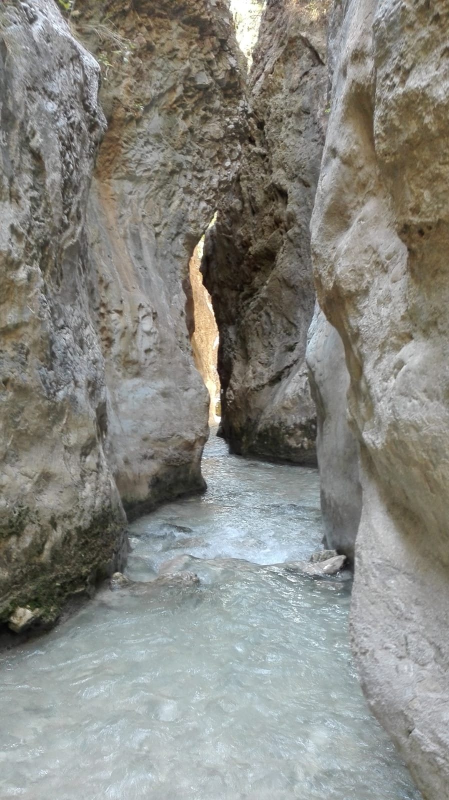
The river hike up the Río Chíllar near Nerja – wading through the stream and traversing the stunning Los Cahorros gorge – has been closed since August 2023. Here is the current situation as of October 2026, what the hike entails, and great alternatives you can do instead. For many years it was the coast's most beloved summer walk: roughly 16 km there and back, spent mostly splashing through shallow waters.
Current status: why is the river closed?
On 7 August 2023, Nerja Town Council decided to close access to Río Chíllar, and the closure came into effect a few days later. The council backed it unanimously. The reason given was the risk of forest fires: the Guardia Civil's environmental police (Seprona), the fire brigade, and the Civil Protection service had warned of the danger, and the public prosecutor's office in Málaga asked the municipality to avoid liability if disaster struck. The gorge is narrow and heavily wooded, and in the event of a fire, it would be extremely difficult to evacuate people.
At the same time, the hike had simply become too popular. Local media reported up to 3,000 visitors per day on summer weekends. On 5 August 2025, the municipality confirmed that access "remains closed", with local police and Civil Protection volunteers guarding the entrance daily – with reinforced patrols at weekends.
Plans to reopen
The river flows through a protected natural park, and it is the Junta de Andalucía (the regional government) that grants permission to use the riverbed itself. The plan is to reopen the hike under regulated access: tickets, a fixed daily visitor limit, and staff stationed at the entrance – much like the Caminito del Rey.
- 2024–2025: Three companies submitted bids, but all were rejected in March 2025 following negative expert evaluations. The river remained closed throughout both 2024 and 2025.
- January–February 2026: The regional government initiated a new tender round. Two proposals were approved for consideration: Iniciativas Turísticas Ardales (Travelnatura) and Construcciones Sánchez Domínguez-Sando.
- 15 May 2026: The proposals were opened for a one-month public consultation (BOJA no. 92).
- June 2026: The environmental organisation GENA-Ecologistas en Acción filed a formal objection, demanding that the entire scheme be scrapped. The group referred to it as a "theme park" inside a protected Natura 2000 and Special Protection Area for birds.
- October 2026: No final decision has been announced. The river remains closed, and no official reopening date has been set.
The proposals reported in the media suggest a season running from 1 May to 1 November, a daily cap of around 500 visitors (one proposal suggests 615), entry from 9:00 am, wristbands, mandatory insurance included in the price, and a ticket costing €4.90–€10 (≈ 74,60 kr.). Vehicles would be barred from the access road, with one proposal mentioning a shuttle bus. These remain proposals – not confirmed regulations.
Do not attempt to enter while the river is closed. The entrance is monitored by the council, there is no mountain rescue service or mobile coverage in the gorge, and the closure exists precisely because evacuation during a wildfire would be nearly impossible. Check the Nerja Town Council website or the local tourist office before making any plans.
The river and the natural park
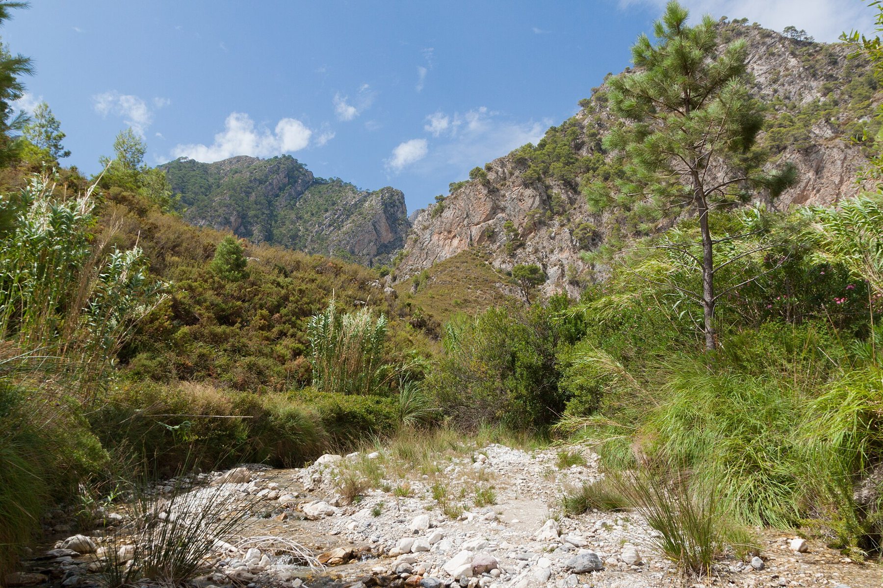
Río Chíllar is approximately 17 km long. It originates high up in the Sierra de Almijara and flows through the municipalities of Cómpeta, Frigiliana, and Nerja before emptying into the Mediterranean just west of Nerja's town centre. Even in midsummer, water flows steadily, which is what makes this walk so extraordinary: you can hike through a cool, flowing river while the surrounding landscape is sunbaked and dry.
Most of the route lies within the Parque Natural Sierras de Tejeda, Almijara y Alhama, established as a natural park in 1999. The park covers roughly 40,660 hectares across 12 municipalities – eight in Málaga province and four in Granada province. Its highest peak is La Maroma at around 2,065–2,069 m (sources vary). The mountains are composed of marble and limestone, the lower slopes are clad in pine forests, and the park is home to one of Spain's largest populations of Iberian ibex (cabra montés) – numbering around 2,000 according to Wikipedia. According to 7 Minutos, the Chíllar is the only river in the area officially designated as a Reserva Natural Fluvial, a protected river reserve.

Guide: what the hike is like (once reopened)
This description is based on the route as it was before the closure. When it reopens under managed access, starting points, entry times, and regulations may change – for instance, one proposal introduces a one-way system.
1. From the car park to the quarry (approx. 2 km, 25 min)
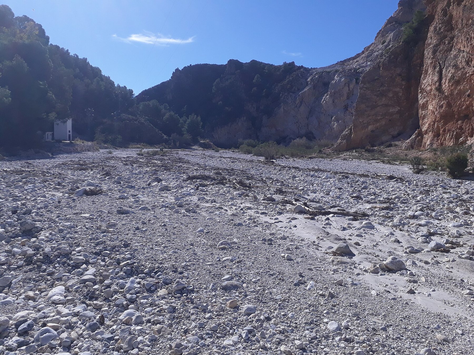
Park at the municipal car park at the far end of Calle Mirto in the northern part of Nerja. From here, walk down the asphalt road Carril de los Almachares towards the river, passing beneath the A-7 motorway to reach an old quarry (la cantera). This is where the river walk officially starts. Parking at the quarry itself is prohibited.
2. Up through the riverbed (approx. 4 km, 1.5–2 hours)
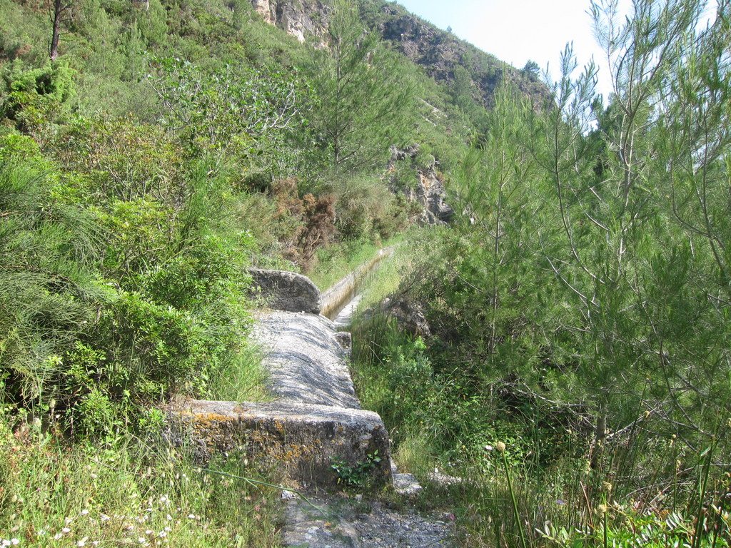
For the first half hour, you walk mostly alongside the water. Along the way, you pass the remains of small, disused power plants, marked on maps as Fábrica de la Luz ("the light factory"), as well as an irrigation canal, an acequia, running along the hillside. Further on, the river fills the entire canyon floor, and the river becomes your path: you wade through shallow, crystal-clear water over pebbles and stones, surrounded by oleanders, reeds, and pine trees.

3. Los Cahorros – the gorge (approx. 6 km from the car park)
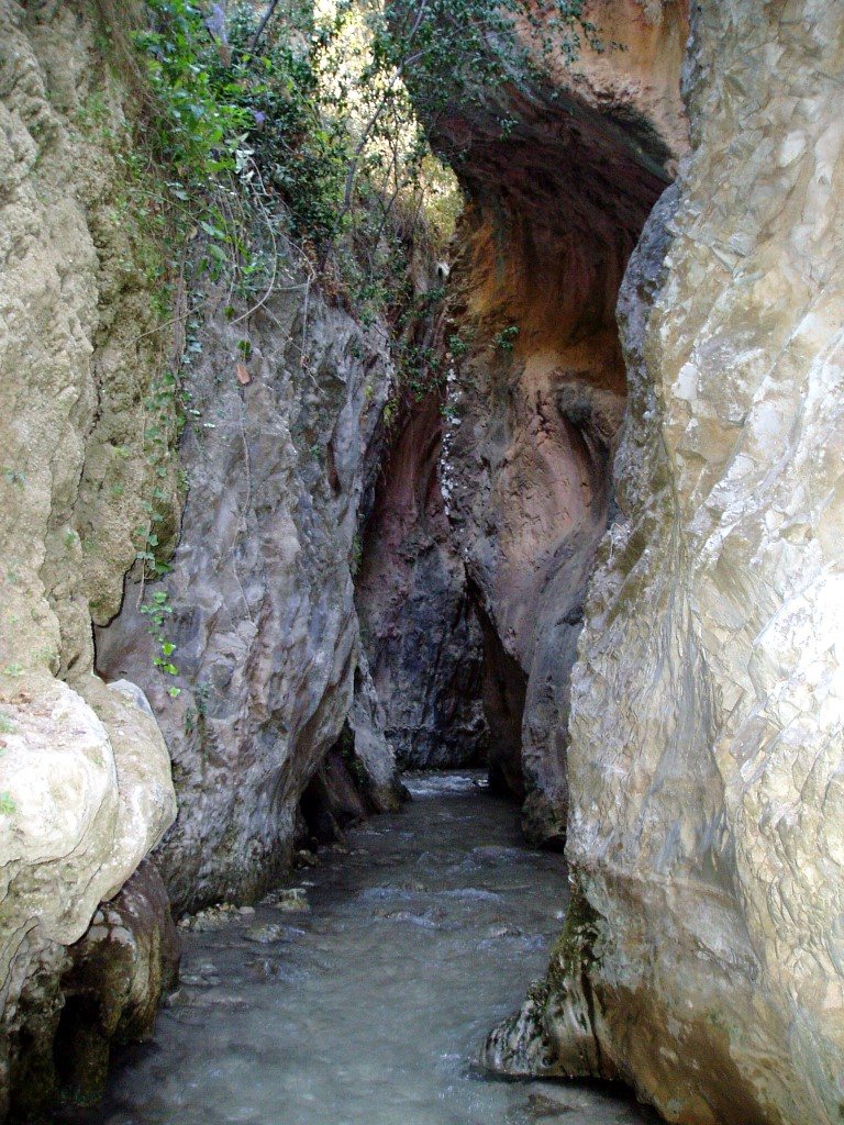
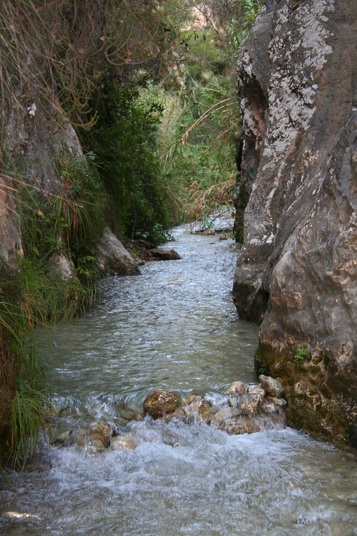
The undisputed highlight of the trek. The valley narrows sharply as the river carves through sheer vertical rock walls. According to Wikipedia, there are three narrow gorges, in places barely a metre wide and over 20 metres high. There is no way around them: you wade directly through the water, which can reach knee height. In Spanish, cahorros refers specifically to these kinds of narrow, slot-like ravines.
4. Vado de los Patos (approx. 8 km from the car park)
Beyond Los Cahorros, the valley opens up once more. After roughly another 1.5 km, you reach Vado de los Patos ("The Ducks' Ford"), a charming little waterfall spilling into a natural pool where many stop for a dip and a picnic lunch. This is the traditional turnaround point. Further up lies a small weir, La Presa, which channels water into the irrigation canals. The route is linear: you return along the exact same path and can turn back whenever you like.
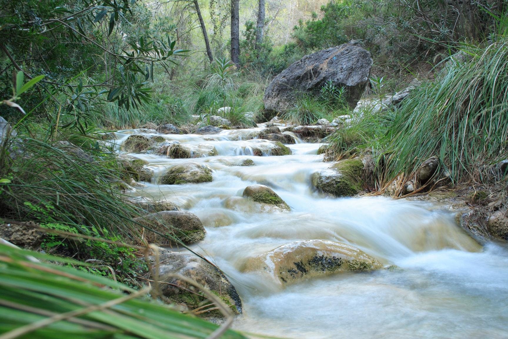
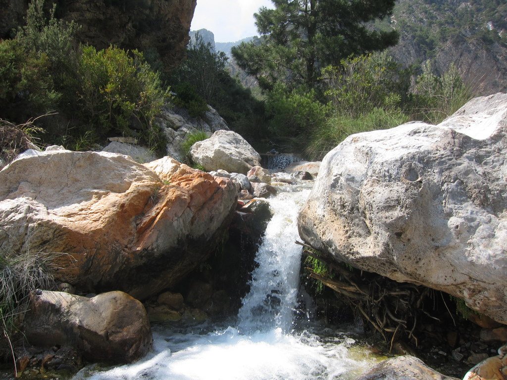
Footwear, water, and equipment
- Footwear: Closed-toe shoes with reliable grip that can withstand getting thoroughly soaked – such as sturdy trekking sandals with heel straps or an old pair of trainers. Avoid waterproof hiking boots (Gore-Tex): water will simply pour over the top and stay trapped inside. Never wear flip-flops.
- Water depth: Typically ankle-deep, reaching knee height through Los Cahorros. After rainfall, the river can rise rapidly. Never enter the canyon following heavy rain or if storms are forecast in the mountains.
- What to bring: At least 1.5–2 litres of water per person, a packed lunch, sun cream, a hat, and a waterproof pouch for your phone and car keys. There are no kiosks or facilities along the route.
- Mobile signal: There is virtually no mobile coverage along most of the hike.
- Difficulty: Not technically demanding, but it is long. Most guides rate it "easy to moderate" or "moderate". It is unsuitable for walking frames, pushchairs, or anyone with knee issues or poor balance – the wet river stones are very slippery.
Can you visit the river right now?
Yes, along its lower reaches. The river flows straight through Nerja town and into the sea at El Chucho beach. A walking path, the Paseo de la Ribera del Chíllar, follows this final section, featuring colourful street art on the riverbed walls. In 2026, the local council commissioned new paving and improved access connecting Calle Antonio Ferrandis "Chanquete" to the beachfront promenade at El Chucho (€188,322 (≈ 1.404.882 kr.) funded by the EU, scheduled for about 2.5 months of works). It is not yet confirmed whether works are fully complete. The closed section is the wild canyon hike further up the valley.

If you want to experience a river with gorges and natural pools right now, take a look at canyoning in Río Verde close to Almuñécar, which is run with professional guides.
How to get there
By car
Join the A-7 towards Málaga and take the Nerja exit. The car park at the end of Calle Mirto is approximately 25 km and a 30-minute drive from Playa Tropical. This stretch of the A-7 is toll-free. The car park is municipal and free to use, offering around 100 spaces according to OpenStreetMap. On Tuesdays (the weekly street market) and Sundays (the car boot sale), a market takes over Calle Mirto right next door, filling up the area throughout the morning. See also parking.
The buttons below the map at the bottom open the route from Playa Tropical directly in Google Maps – both the speedy motorway route via the A-7 and the scenic coastal drive past Maro and the aqueduct. The walking route up the riverbed is also shown, though it can only be used once access is officially restored.
By bus
ALSA's coastal service Motril–Málaga runs from Almuñécar bus station via La Herradura and Maro to Nerja. The journey takes 20–30 minutes. From the bus stop on Avenida Ciudad de Pescia in Nerja, it is roughly a 1.8 km (25-minute) walk to the car park in Calle Mirto, and about 3.6 km (50 minutes) to the quarry where the river walk begins. Timetables vary according to the season, so check ALSA before setting off. See also buses.
Sights along the way
Follow the old coastal road N-340 for the final stretch between Maro and Nerja.
- Mirador de Cerro Gordo (13 km): a dramatic viewpoint over La Herradura bay and the cliffs towards Maro, with a restaurant and free parking just off the old N-340.
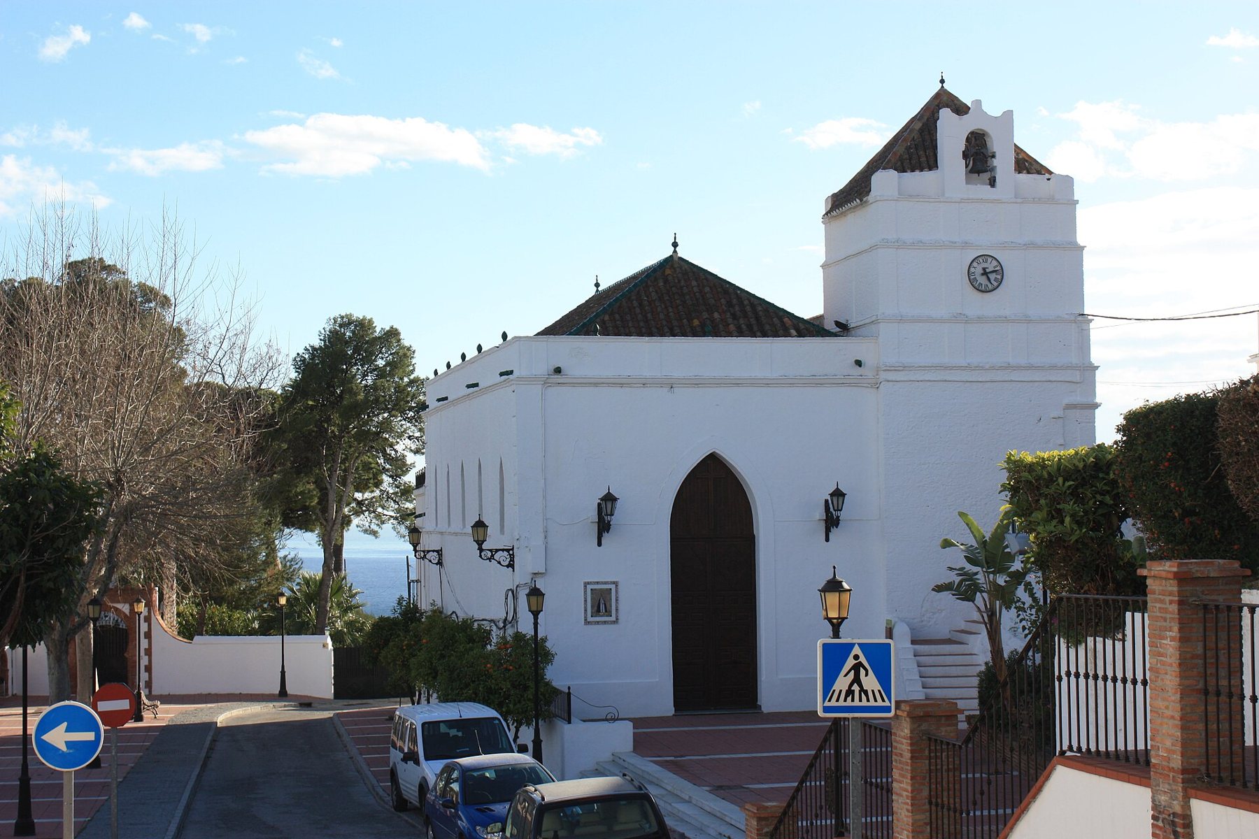
- Maro (approx. 23 km): a picturesque whitewashed village perched on the cliffs overlooking the sea, featuring the church of Nuestra Señora de las Maravillas on the square and views of coastal greenhouses and cliffs. Right alongside are the famous Nerja Caves.
- Acueducto del Águila: The Eagle Aqueduct between Maro and Nerja – four tiers of red brick arches spanning a steep ravine, built in the 19th century to supply water to the sugar refinery in Maro. It is best admired from the old N-340.
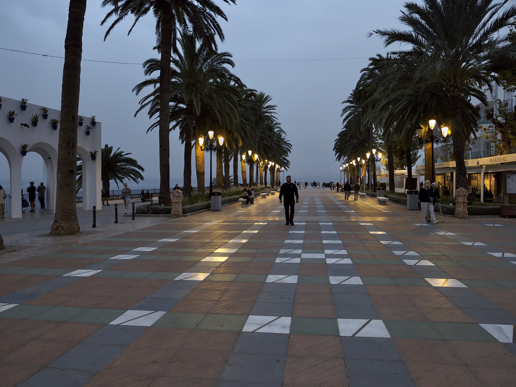
- Nerja and Balcón de Europa: the iconic viewing terrace set atop a rocky promontory in the centre of town, lined with palm trees, historic cannons, and a statue of King Alfonso XII. A lovely spot for lunch after a walk. Read more in our article on the Nerja Caves and Nerja town.
- Frigiliana: the postcard-perfect white village perched 6–7 km above Nerja. The Chíllar valley sits between Nerja and Frigiliana, and part of the river falls within Frigiliana's boundary. See Frigiliana.

Sugar and electricity – the river's history
The Chíllar has long been Nerja's lifeblood. As early as 1515, the river was designated as the municipal boundary when Nerja was granted its territory, with its water powering mills and irrigating crops. In 1591, the San Antonio Abad sugar mill was built on its banks, and for centuries the valley flourished with sugar cane cultivation. According to Spanish Wikipedia, Nerja's final working sugar refinery, Azucarera San José, ceased operations in 1968.
Later, the river's gradient was harnessed to generate electricity: the small hydro installations known to hikers as Fábrica de la Luz can still be spotted along the banks – OpenStreetMap notes both a "second" and "third" Fábrica de la Luz. Firm records confirming their exact construction and closure dates remain elusive. Meanwhile, irrigation channels fed by the weir further up continue to supply water to fields lower down the valley.
Food
There are no shops or facilities along the hike itself, so pack lunch and plenty of refreshments to enjoy by the waterfall. Afterwards, Nerja is a fantastic place to dine. Belonging to the Axarquía region in Málaga province, the local gastronomy celebrates the best of the coast:
- Fish and seafood: boquerones (fresh anchovies, either deep-fried or marinated in vinegar), fritura malagueña (a platter of crispy mixed fried fish), and espetos – fresh sardines skewered on canes and grilled over olive-wood fires on the beach.
- Ajoblanco: a refreshing chilled soup made from crushed almonds, garlic, bread, and olive oil, topped with grapes – pure bliss after a warm walk.
- Miel de caña: dark sugar cane syrup produced in neighbouring Frigiliana, a sweet reminder of the area's sugar heritage. It is delicious drizzled over crispy fried aubergines.
- Where to eat: the streets encircling Balcón de Europa and Plaza de España are lined with lively tapas bars and restaurants. If you wander a few streets deeper into the old town, you'll find quieter and often cheaper spots. Down at Burriana beach, you can feast at beachfront chiringuitos – discover more in our Nerja guide.

Discover more local dishes: food traditions and 3×10 things to taste, eat, and visit.
Toilets
- On the trail: there are no public toilets whatsoever – neither at the car park, the quarry, nor along the river gorge. Make use of facilities in town before departing, and bring waste bags to ensure you leave no trace in the natural park.
- Calle Mirto car park: we have been unable to confirm any public conveniences at the car park.
- Nerja town: pop into a local café or bar – buying a quick coffee makes using their facilities easy. Burriana beach offers public toilets, including accessible facilities.
- Nerja Caves: clean customer toilets are available near the entrance if you are pairing your day trip with a visit to the caves.
Festivals and traditions
- Día de la Cruz, around 3 May: local associations and neighbours craft elaborate floral crosses throughout the streets, competing for municipal prizes. The whitewashed lanes of the old town are draped in vibrant, festive decorations.
- San Isidro, 15 May: Nerja's beloved romería – following Mass at the Church of El Salvador, the town joins a joyful pilgrimage procession to the San Isidro hermitage by the Nerja Caves. San Isidro is the patron saint of farmers. The caves are closed on this day.
- Virgen del Carmen, 15–17 July: the patron saint of fishermen is carried in procession through town on 16 July and taken out to sea in a flotilla from Calahonda beach beneath the Balcón de Europa.
- Feria de Nerja, second week of October: the town's lively annual fair celebrating its patron saints, the Virgen de las Angustias and San Miguel.
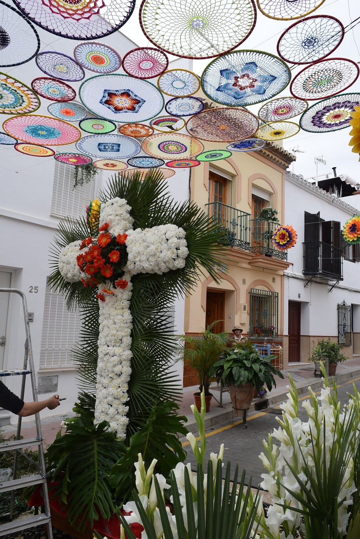
Discover more local festivities along the coast on our festivals page.
Suggested day itinerary (while the river remains closed)
| Time | Facility |
|---|---|
| 09:00 | Drive from Playa Tropical along the A-7, taking the Maro exit |
| 9:30 | Nerja Caves (book tickets online in advance), followed by a brief stroll to Maro's village church |
| 11:30 | Admire the Eagle Aqueduct from the old N-340 as you head into Nerja |
| 12:00 | Walk along the Ribera del Chíllar down to the sea at El Chucho, continuing on to Balcón de Europa |
| 14:00 | Enjoy a relaxed lunch in the historic centre |
| Afternoon | Head up to Frigiliana (6–7 km) before returning home via the A-7 |
Maps and routes
Red star = Playa Tropical. Click on a point for the name and distance. Map data © OpenStreetMap.
Open the route in Google Maps
- Drive from Playa Tropical to the Calle Mirto car parkApprox. 25 km, 30 min via the A-7 towards Málaga, exit Nerja. Free parking. The river hike itself is closed – check current status before setting out.
- Via the scenic old coastal road past MaroTakes in Maro and the Eagle Aqueduct along the way, ending at the Calle Mirto car park.
- Day trip: Maro, Nerja town, and returnMaro, the aqueduct, a walk along Ribera del Chíllar to the beach, returning via the A-7.
- The Chíllar hike on foot (once reopened)From the car park to the quarry and up through the riverbed to Los Cahorros and Vado de los Patos, approx. 8 km each way. Closed as of October 2026.
The routes start at Playa Tropical. On mobile devices, they open directly in the Google Maps app, ready for navigation.
Good advice
- Check the status before you go. The river has been closed to visitors since August 2023. Consult nerja.es or ask at Nerja's tourist office.
- Do not enter while closed. Local authorities patrol the entrance, and there is no mobile reception or rescue coverage inside the canyon.
- Book well ahead once it reopens. With visitor numbers likely capped around 500 per day, pre-booking will almost certainly be essential.
- Arrive early. Set off early in the morning to beat both the heat and the crowds. Avoid weekends and August, which were historically the busiest times.
- Wear water-friendly shoes, not waterproof ones. Choose supportive hiking sandals or old trainers with good tread – never Gore-Tex boots or flimsy flip-flops.
- Keep an eye on the weather. The river can rise swiftly after rain in the surrounding mountains. Never enter the Cahorros during unsettled weather.
- Take all rubbish back with you. There are no bins or public facilities anywhere along the trail.
The hike is lengthy (5–7 hours) and involves walking across slippery river stones submerged in water. It is not suitable for anyone with knee trouble, impaired balance, or walking aids. If you wish to experience the river without committing to the full wilderness trek, enjoy the pleasant stroll along the urban Ribera del Chíllar in town.
Sources
- Nerja Town Council: Full council unanimously ratifies temporary closure of Río Chíllar for safety reasons
- Nerja Town Council 05-08-2025: Access to Río Chíllar remains closed
- Nerja Town Council 11-11-2025: Clearing and maintenance works in Río Chíllar
- Nerja Town Council 04-02-2026: Improvements awarded for Ribera del Chíllar access
- Nerja Town Council: Cruz de Mayo 2026 awards
- BOJA no. 92, 15-05-2026: Public consultation on controlled access to Río Chíllar
- Junta de Andalucía: Natural Park Declaration for Sierras de Tejeda, Almijara y Alhama
- El Español 15-04-2026: Regional government evaluates two reopening projects and 18-07-2025: Closed for another summer
- Euro Weekly News 24-05-2026: Proposals for controlled reopening
- The Seaside Gazette 16-05-2026: Río Chíllar Access Problem
- 7 Minutos 28-06-2026: Environmentalists oppose reopening
- Provincia de Málaga: Río Chíllar – is it open? (updated October 2026)
- Senderos Andalucía: Sendero acuático Río Chíllar and Andalucia Hiking: Rio Chillar (route details, footwear, water advice)
- Wikipedia (en): Chíllar River and Wikipedia (es): Chíllar
- Wikipedia (en): Sierras of Tejeda, Almijara and Alhama Natural Park
- Wikipedia (es): Nerja (sugar heritage, local festivals)
- EsNerja: The Calle Mirto weekly market
- Driving and walking distances: OSRM/OpenStreetMap
- Coordinates: OpenStreetMap contributors (ODbL)
Krone amounts are converted at 1 € ≈ 7.46 kr. and rounded.